The island of Ibiza has hundreds of wonderful corners to explore to discover and enjoy the environment and fresh air, either alone or with family or friends, although it is always advisable to enjoy the routes with a companion to ensure safety.
The routes listed below have been differentiated by degree of difficulty.
LOW LEVEL WALKING ROUTES
IBIZA / CAP MARTINET / S’ESTANYOL
This is a walking route suitable for almost everyone, you can even take baby prams suitable for hiking.
This walking route starts from the Port of Ibiza. From there we take the Paseo Juan Carlos I, where we continue until we reach the roundabout and turn left onto Avenida 8 d’Agost and from there to the beach of Talamanca, where we take the wooden walkway with the sea always on our right.
- Free camping is not authorized.
- Most of the recommended paths cross private properties. If you are accompanied by a dog, always keep it on a leash.
- Fires are prohibited. A poorly extinguished cigarette can cause a fire.
- Do not litter. Put your garbage in the bins.
- Plan the activity well and get information about the weather forecast.
- Wear appropriate footwear.
- Respect the flora and fauna.
112: EMERGENCY PHONE When we arrive at Sa Punta Restaurant we take a street on the left hand side until we reach Avenida Cap Martinet, where we will continue until reaching a crossroads and turn left.
Depending on physical endurance, a short rest may be advisable before continuing along the same street and finding a dirt track that goes uphill which we follow until the slope begins to descend.
 Playa s’Estanyol. M Copa
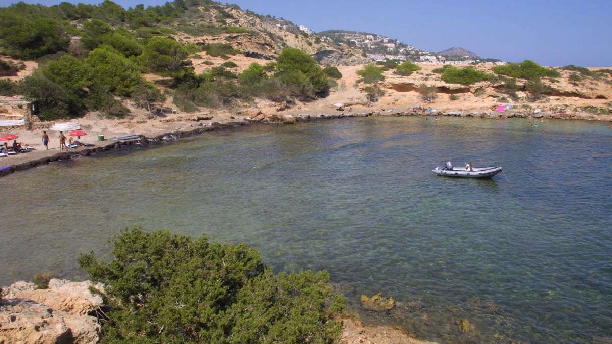
At this point, we will continue to the right along a track that will later become a path that passes next to a white electricity transformer hut, then on to a wide path on the right that goes down to the beach of s’Estanyol, where hikers can rest and take a refreshing swim, weather permitting.
To return, we will need to again take the track we arrived by until the asphalted road previously mentioned and turn left towards Jesús.
After leaving behind the village’s football field, we see a crossroads to head towards Ibiza-Cap Martinet (on the left hand side). Cross the road and follow the asphalted path that passes between stone walls. From this point we will see a splendid panoramic of the village of Jesús.
Without leaving the path, we will again end up in avenida 8 d’Agost, where we find an ice-cream parlor. From here, we continue to the left until the next pedestrian crossing, where we cross to place us in front of the Ibiza Gran Hotel. We continue until the first crossing on the left hand side that takes us to Paseo Juan Carlos I which we take towards Ibiza, where we find the end of our route.
- Starting point: Port of Ibiza
- Estimated time: 2.5-3 hours
- Distance: 13,3 km
CALA LLONGA / SÓL D’EN SERRÀ
This is a return walking route suitable for people who already have some hiking experience and it is not recommended to take baby prams.
We start the walk on the beach of Cala Llonga (Santa Eulària), on the right side facing the sea, right next to the Red Cross hut, where we see an asphalted road that goes up towards the Can Porxet neighborhood. From the hotel, the road becomes dirt and climbs steeper and steeper, showing us the beautiful views over the beach of Cala Llonga.
When the road goes deeper into the forest you have to pay attention, because about 100 meters to reach the highest point, on the right, a path marked with stones opens up. We take this path that is constantly marked with stones on both sides and follow it until it turns to the left and in front of us we find the ancient remains of what looks like a tower and that according to experts is a hut of the nearby Phoenician settlement.
 Sól d’en Serrà.Toni Escobar
From these ruins there is another path also marked with stones that takes us directly to the ancient Phoenician settlement of Cap des Llibrell, right at the top of the Puig de Ses Terrets, from where we can admire the magnificent views which stretch the island of Tagomago, the islets of es Canar and Santa Eulària, Formentera, the Puig des Castellar and the Sól d’en Serrà.
From the village we return to the path by which we arrived and on the left hand side we will find two poorly marked paths that go into the forest. We must take the second, which leads us to a better marked path along which we will continue until we get close to the cliff and up to Puig des Castellar, 184 meters high. Again, stopping to take in the spectacular views is a must.
From there a well marked path with a steep slope begins where care must be taken. Following this path we will arrive at the parking area of the Sól d’en Serrà beach. Taking the path to the right we will soon reach the beach of Cala Llonga, our starting point.
- Starting point: Cala Llonga
- Estimated time: 2 hours
- Distance: 4.7 km
- Difference in altitude: 215 meters
POINTS OF INTEREST
- Ancient Phoenician settlement of Cap des Librell
- Geodetic vertex of Puig de ses Terrets at 220 m altitude
- Geodetic vertex of Puig de Es Castellar at 184 m altitude
MEDIUM LEVEL WALKING ROUTE
SANT ANTONI / CALA SALADA
Enjoy the fantastic views of the bay of Portmany and the islet of sa Conillera, one of the most spectacular of the island, on this medium level walking route. Although it is a walking route suitable for almost everyone, its 3-3.5 hour duration makes it advisable to wear comfortable clothes and shoes. Prams cannot access all points of the route.
The walking route begins at the town hall of Sant Antoni, which is located on the promenade of the port of the town, and from there we will take the promenade that goes along the coast towards the beach of Caló des Moro. It passes by iconic places where tourists enjoy Portmany’s famous sunset, such as the Café del Mar or Mambo, as we continue the walk with the sea always to our left.
After Caló des Moro we arrive at Sa Cova de Ses Llagostes which we will pass behind taking the path that continues along the coast.
Soon we will arrive at the next beach: Cala Gració, which we cross to then climb the stairs to reach Cala Gracioneta, which we also cross, always following the path along the sea.
 Cala Salada Xescu Prats
Continuing a little further we arrive at Punta Galera, one of the Ibicencos most appreciated coves for its crystalline waters, and continue until what people know as Cala Yoga, where the road is now asphalted.
Just after passing a tennis court, we will find a crossing with an alley on the right where we will see some stairs that will lead us to our destination: Cala Salada.
- Starting point: Sant Antoni Town Hall
- Estimated time: 3-3.5 hours
- Distance: 12.3 km
- Climb: 77 meters
POINTS OF INTEREST
- Port of Sant Antoni
- Views of Sa Conillera and S’Illa des Bosc, Cap Nunó and Sa Punta Forada
- Punta Galera and Cala Salada
HIGH LEVEL WALKING ROUTES
SANT JOSEP
Finding a panoramic view of almost the entire island with your feet on the ground is possible. The estimated time for the walking route from Sant Josep to sa Talaia is five hours on a return route of 14 kilometers with a difference in altitude of 354 meters.
It is advisable to wear comfortable shoes, breathable clothing, sunscreen and raincoat if taking the walking route in autumn or winter. It is important not to forget sunscreen, water and lunch.
The walking route starts at the Church of Sant Josep. Cross the road and take the garden street. When you reach the bar, turn right onto calle sa Talaia. It is a cobbled street flanked on the right by a stone wall. At the end of the street, turn right and take the next dirt road on the right that becomes a narrow path with a white wall on the left that goes into the forest.
When you reach a crossroads, take the path that goes up to the left, which leads to a forest track and, at the end of this, turn right where there is a sign indicating the path to follow.
It’s a sloping path. It continues until a crossroads past the Puig Cardona, where there is a fence on the right. Take the path that goes to the right parallel to the fence and continue to a forest track where there are some television antennas. From the antennas you can enjoy a panoramic view of almost the whole island.
 Church of Sant Josep. Joan Costa
Then follow the path downhill until you reach the next crossroads where you turn left and take the path called Camí des Puig Blanc, until you reach a fork that you have to take on the right until the next path on the left hand side by which you go down until you find a path marked with a rock on the left hand side with the inscription ‘Bicis’ (Bicycles).
Follow this path which runs between the terraces until you find a steep path that goes down to the right, marked with white arrows on the ground. Go down until you reach an esplanade and take a path on the left hand side marked with the ruta BTT 12. Pass a crossroads and go straight on, leaving a path on the right.
Continue downhill and at the next crossroads turn left, until the next crossroads where you have to go straight on, leaving a path on the left. Continue downhill until arriving at a stream and then another stream that crosses the path from left to right.
You will reach a curve, where you continue straight ahead, leaving a rise on the left. Continue along the main road without deviating until you reach an asphalt road that you must also follow straight ahead until you reach the third road on the left, also asphalted. In front of this road there is a threshing floor .
Continue along the asphalt road that goes up until you find a fence that cuts it and take the dirt road on the left. It continues until a curve in which on the right hand side there is a little marked path that ascends until arriving at an old cultivation area, pass through here, sticking to the left side until the same path enters the forest.
When arriving at the first crossing, turn right and then turn left at the following crossing, leaving a house on the right hand side. Continue down the main road until you reach a crossroads where you take the path on the right that continues downhill until you reach a new crossroads where you turn left.
The route follows the main road until you reach another crossroads that goes up on the left hand side leaving a well on the left and follow the road until you reach a path on the left hand side ten meters before the entrance of a house. Take it and follow it until you reach the fence where you continue along the first path used in the ascent to sa Talaia but this time back to Sant Josep.
- Starting point: Church of Sant Josep
- Estimated time: 4.5-5 hours
- Distance: 143 km
- Elevation gain: 354 meters
POINTS OF INTEREST
- Church of Sant Josep
- Top of sa Talaia (highest point of the island with 475 m)
- View of practically the whole island and of the Parc Natural des Illots de Ponent
THREE WALKING ROUTES IN ONE FOR THE INTREPID HIKER
SANT JOAN
The complete itinerary starts at Cala Gració and runs along almost the entire north coast of the island, from Sant Antoni to the lighthouse of Portinatx, always from west to east. It is recommended to bring a compass on this route.
Of course, the walking route can be divided into sections if you want to enjoy the scenery and nature. Therefore, we recommend dividing the route into three stages: one to Santa Agnès de Corona (5 hours); another to the port of Sant Miquel (6 hours); and the last one to the lighthouse of Portinatx (4 hours). Do not forget to check the bus timetables for the return trip.
 Moscarter lighthouse. Xescu Prats
The walking route starts at the seashore in Cala Gració, always along a coastal path, passing behind the Puig de Nunó and es Corrals d’en Guillem. Then we can take the road from Santa Agnès until we reach the village, where we will find a detour to the left that will take us to Cala d’Aubarca passing through Camp Vell, one of the most unspoiled areas of the island with views worth stopping for.
If we continue walking along the pla de Sant Mateu we reach the urbanization Illa Blanca and na Xemena that we must cross to go down to port of Sant Miquel. From the beach, direction Sant Miquel, on the left, there is a detour to Benirràs that passes by the cave of Can Marçà.