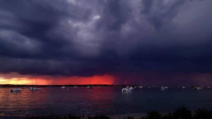
The State Meteorological Agency (Aemet) forecasts that the Balearic Islands Day this Friday, March 1st, will be marked by variable weather, with possible precipitation from noon onwards on all the islands.
This has been assured by the delegate of the Aemet in the Balearic Islands, María José Guerrero, in statements to Europa Press, in which she anticipated a last week of winter Februarywith seasonal highs, showers and thunderstorms, with possible hail and strong wind.
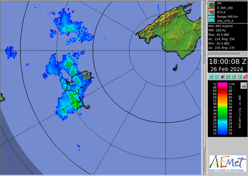
In Ibiza and Formentera, thehe Aemet forecasts rain and thunderstorms this Monday afternoon. In the day of this Monday have been recorded wind gusts of up to 68 kilometers per hour at Ibiza airport.
Yellow alert
The tuesdaythe Aemet forecasts the possibility of thunderstorms until 12 noon. From wednesdaymeteorologists say there will be sunny skies with cloudy intervals in the Pitiusas with yellow risk for bad sea. The Aemet forecasts waves up to three meters high from midnight until 12 noon with north wind.
Thus, the Balearic Day in Ibiza and Formentera, will wake up with cloudy intervals. Temperatures will range between 8 minimum and 18 maximum and there is a 45% chance of precipitation after noon.
Rain, hail and strong winds in the rest of the Balearics
The delegate of the Aemet in the Balearic Islands has detailed that this Monday has already begun with some precipitations. Although, according to has pointed out, the strongest showers are expected to occur at the end of this day, in the form of hail, and may be accompanied by thunderstorms. Meanwhile, facing Tuesday, added the delegate of the Aemet in the Balearic Islands, it is expected that continue the unpleasant weather, with showers which, again, may be in the form of hail. In addition, it could snow above 1,200 meters. And, on Wednesday, above 1,000.
As for the temperatures forecast for these first days of the last week of February, Guerrero has detailed that the maximum temperatures will be around 12 or 14 degrees Celsius.
And, in relation to the wind, the week begins with this blowing with less intensity than in previous days. On Tuesday it will continue moderate from north and northwest although an episode of strong intervals of Tramuntana will begin in Menorca, which will last until Thursday, affecting previously, on Wednesday, in addition, to the northeast of Mallorca.
As the week progresses, on Thursday, the low at high levels that has given rise to this winter weather will move, leaving a day with few clouds and a rise in maximum temperatures, which could make them reach 19ºC on that day.
This transitory improvement will last until midday on Friday, Balearic Day, and holiday in the autonomous communityaccording to the delegate of the Aemet in the Islands, who, however, has specified that from the afternoon will reach the archipelago another trough that could lead to new rainfall.
Precipitations that would continue facing Saturday, March 2, according to the forecasts provided by the Aemet in the Balearic Islands, which warn that, once left behind the blocking anticyclone, the forecast is of variable weather, accompanied with strong winds.


 Rain radar in Ibiza and Formentera | Follow the evolution of the weather live